It might feel like we’re in the dead of winter at the moment, which is probably because we are. Sunday, July 2, marked the exact middle of the year. Meanwhile, everywhere else….
Yesterday, July 3, planet Earth recorded the hottest day ever since records began in the mid-1800s, with an average global temperature of 62.62 degrees Fahrenheit. In Celsius terms that’s a balmy 17 degrees.
The recording is calculated by measuring air temperatures in multiple locations two meters above the Earth’s surface. The previous record for was set in July last year and August 2016, when the average global temperature reached 62.46 degrees.
Experts put the record-breaking run of hot weather down to recent heat waves in the US, Canada and Europe, along with El Nino, where sea surface temperatures in the Pacific Ocean experience above average rises.
The data records go back to 1979, but researchers claim they’re comparable with data that goes back much further, hence they’re confident this is the highest global temperature since instrumental measurements began around the 1850s.
Closer to home, according to the Bureau of Meteorology (BOM), Australia’s “national area-average mean temperature” was 1.12 °C above the 1961-1990 average for June, which is the seventh-highest on record since 1910.
“Mean maximum temperatures for June were warmer than average across Australia’s north and east and the warmest on record for much of Queensland. Mean maximum temperatures were below average for most of the western two thirds of Western Australia.
“Mean minimum temperatures were above average for the Northern Territory and Queensland away from the south-east, for western and southern New South Wales, Victoria, Tasmania, much of South Australia and for most of the Western Australia’s Kimberley. Mean minimum temperatures were below average for large parts of the central and western Western Australia and for an area in the north-east of New South Wales.”
Things were also decidedly above average for rainfall in Australia. Nationally, June 2023 recorded rainfall that was 24.6 per cent above the 1961-1990 average. In particular, the southern coast of Western Australia, and the north-west to the south-east of the continent (plus Tasmania) experienced high rainfalls.
At the same time, according to BOM, “Rainfall was below average for most of central and eastern Queensland, coastal New South Wales extending inland and into far eastern Victoria, and for a large area in the west of Western Australia.”
Australia is believed to be emerging from three consecutive years of El Nina, with a 70 per cent chance we’ll enter an El Nino phase this year, which commonly brings drought to large sections of the Australian continent.
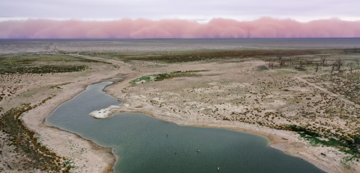
(MAIN IMAGE ABOVE: A dust storm in the distance from Lake Menindee, in the Far West of NSW, pictured in April 2020. The image was captured by New Matilda editor Chris Graham, with a drone. He happened to be filming the lake for a documentary about the drought, when the dust storm blew in. Dust storms are common in Outback Australia during drought, and can often travel thousands of kilometres before dissipating. They’re contributing to Australia’s alarming rising salinity levels, on the back of Australia’s already terrible environmental record).
Donate To New Matilda
New Matilda is a small, independent media outlet. We survive through reader contributions, and never losing a lawsuit. If you got something from this article, giving something back helps us to continue speaking truth to power. Every little bit counts.


